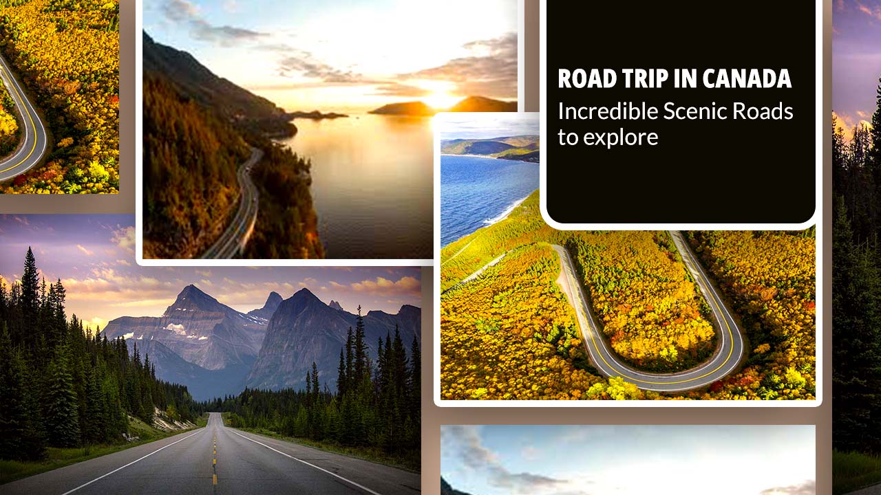
Canada, the world’s second-largest country, is a land of varied landscapes and breathtaking natural beauty. From coast to coast, this vast nation offers some of the most stunning scenic drives you’ll ever experience.
Whether you’re a nature enthusiast, a photography buff, or simply someone who loves to hit the open road, Canada has something special in store for you. In this article, we’ll take you on a road trip in Canada on 10 of the most incredible scenic roads that showcase the best of Canada’s natural wonders, rich history, and vibrant culture.
1. Icefields Parkway, Alberta
Our journey begins in the heart of the Canadian Rockies with the Icefields Parkway. This 232-kilometer stretch of highway connects Banff National Park to Jasper National Park, offering a drive through some of the most spectacular mountain scenery in the world.
Key Features:
- Length: 232 kilometers (144 miles)
- Duration: 3 hours without stops, but plan for a full day to enjoy the sights.
- Best Time to Visit: June to September for the best weather and road conditions
Over 100 ancient glaciers, cascading waterfalls, and turquoise lakes surround you as you cruise along this two-lane highway. The road winds its way through valleys carved by glaciers, offering glimpses of wildlife like bighorn sheep, elk, and even the occasional bear.
One of the highlights of this drive is the Columbia Icefield, the largest ice field in the Rocky Mountains. Here, you can take a guided tour onto the Athabasca Glacier, walking on ice that’s hundreds of meters thick. The recently opened Glacier Skywalk, a glass-floor observation platform, provides heart-stopping views of the Sunwapta Valley below.
Don’t miss these stops along the way:
- Lake Louise: Known for its vibrant turquoise waters and surrounding peaks
- Peyto Lake: Shaped like a wolf’s head, this glacier-fed lake is famous for its bright blue color.
- Athabasca Falls: A powerful waterfall carving its way through layers of tough quartzite and limestone
The Icefields Parkway is more than just a road; it’s a journey through time, showcasing the raw power of glacial erosion and the stunning beauty it leaves behind. Remember to fill up your gas tank before setting out, as services along the route are limited.
2. Cabot Trail, Nova Scotia
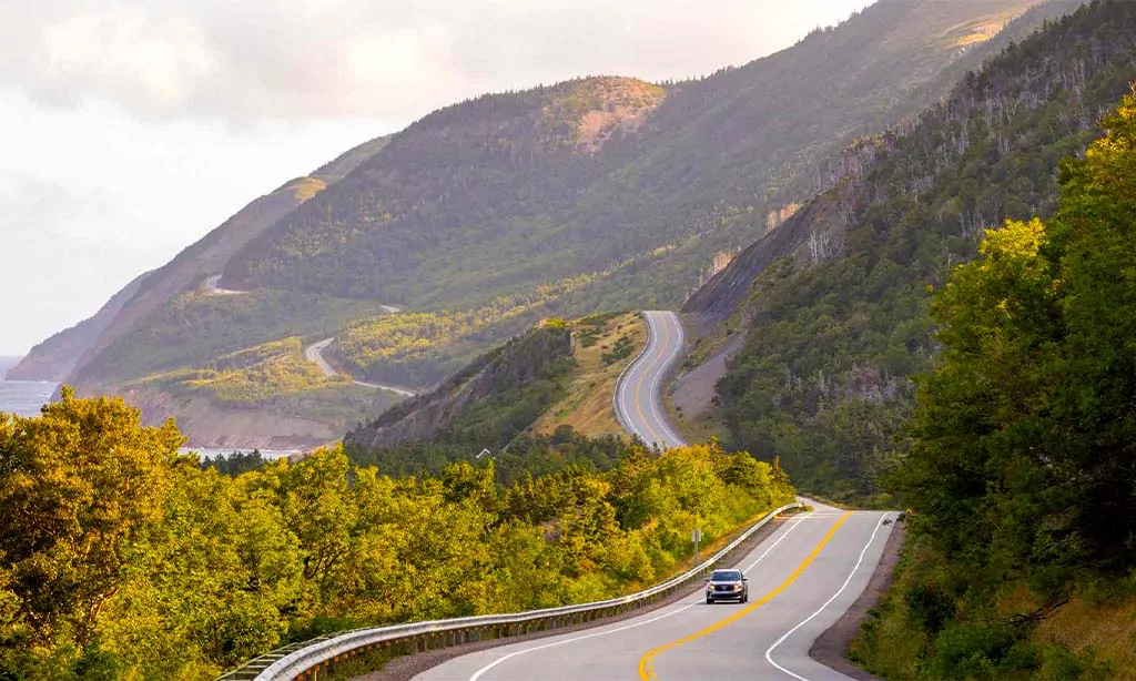
From the rugged peaks of the Rockies, we move to the eastern shores of Canada to explore the Cabot Trail. Many people often rank this 298-kilometer loop around the northern tip of Cape Breton Island in Nova Scotia as one of the world’s most scenic drives.
Key Features:
- Length: 298 kilometers (185 miles)
- Duration: 5 hours without stops, but we recommend 3-5 days to fully experience the area.
- Best Time to Visit: September to October for fall foliage, June to August for whale watching
The Cabot Trail winds through Cape Breton Highlands National Park, offering dramatic coastal views, lush forests, and charming fishing villages. As you drive, you’ll transition between quiet beaches, highland scenery, and dense forests, all while hugging the coastline of the Gulf of St. Lawrence and the Atlantic Ocean.
This region is rich in Acadian and Celtic culture, reflected in the local music, cuisine, and craft traditions. Be sure to stop in some of the small towns along the way to experience the warm hospitality of the locals and perhaps catch a traditional ceilidh (a social gathering with folk music and dancing).
The Cabot Trail’s highlights include:
- Skyline Trail: A 7-kilometer hiking trail offering stunning coastal views and potential wildlife sightings
- Ingonish Beach: A beautiful sandy beach, perfect for a refreshing swim.
- Chéticamp: A picturesque Acadian fishing village known for its rug-hooking tradition
The Cabot Trail is not just about the views; it’s an immersive experience into the culture and natural beauty of Atlantic Canada. Keep an eye out for whales off the coast, especially from May to October, and bring your hiking boots to explore some of the 26 trails in the national park.
3. Sea-to-Sky Highway, British Columbia
Our next scenic drive takes us to the west coast of Canada, along the famous Sea-to-Sky Highway. This 120-kilometer route from Vancouver to Whistler offers a stunning transition from coastal rainforest to alpine vistas.
Key Features:
- Length: 120 kilometers (75 miles)
- Duration: 1.5 hours without stops, but we recommend a full day to fully enjoy the attractions.
- Best Time to Visit: Year-round, but summer offers the best weather for outdoor activities.
Also known as Highway 99, the Sea-to-Sky Highway lives up to its name, taking you from the shores of the Pacific Ocean to the peaks of the Coast Mountains. The road hugs the coastline of Howe Sound, offering breathtaking views of fjords, islands, and snow-capped mountains.
This drive is not just about natural beauty; it’s also rich in cultural significance. The route passes through the traditional territories of the Squamish and Lil’wat First Nations, and there are several opportunities to learn about their history and culture along the way.
Important locations along the Sea-to-Sky Highway are as follows:
- Shannon Falls: BC’s third-highest waterfall, tumbling 335 meters down a granite cliff
- Stawamus Chief: A massive granite monolith popular with rock climbers and hikers
- Squamish: The outdoor recreation capital of Canada, known for wind sports and rock climbing
- Brandywine Falls: A spectacular 70-meter waterfall with an accessible viewing platform
The journey ends in Whistler, a world-renowned ski resort that hosted events for the 2010 Winter Olympics. Even in summer, Whistler offers plenty of activities, from mountain biking to hiking and enjoying the vibrant village atmosphere.
The Sea-to-Sky Highway showcases the diverse landscapes of British Columbia, from lush temperate rainforests to alpine meadows, all within a relatively short distance. It’s a testament to the incredible natural diversity that Canada has to offer.
4. Viking Trail, Newfoundland and Labrador
Our journey now takes us to Canada’s easternmost province, Newfoundland and Labrador, to explore the Viking Trail. This 489-kilometer route offers a unique blend of natural wonders and historical significance.
Key Features:
- Length: 489 kilometers (304 miles)
- Duration: 6 hours without stops, but we recommend 3-5 days to fully explore the area.
- Best Time to Visit: June to September for the best weather and to see icebergs
The Viking Trail stretches from Deer Lake to St. Anthony, taking you through Gros Morne National Park, a UNESCO World Heritage Site, and ending at L’Anse aux Meadows, the site of a 1,000-year-old Viking settlement.
Drive north along the western coast of Newfoundland to witness a diverse landscape of fjords, mountains, and coastal plains. The geology of Gros Morne National Park is particularly noteworthy, offering a rare glimpse into the earth’s mantle and the process of continental drift.
The Viking Trail boasts several key attractions.
- Western Brook Pond: A landlocked fjord carved by glaciers, best explored by boat tour
- Tablelands: An otherworldly landscape of exposed earth’s mantle, usually found deep below the ocean floor.
- L’Anse aux Meadows: The only known Norse settlement in North America, dating back to around 1000 CE
The Viking Trail is not just about scenery; it’s a journey through time. From the ancient rocks of Gros Morne to the remnants of Viking settlements, this drive offers a unique perspective on both natural and human history.
Keep an eye out for icebergs off the coast from spring to early summer, as well as whales from mid-June to September. The locals, known for their warm hospitality, have a saying: “Come as a stranger, leave as a friend.” Expect an invitation for a cup of tea and a conversation!
5. Dempster Highway, Yukon and Northwest Territories
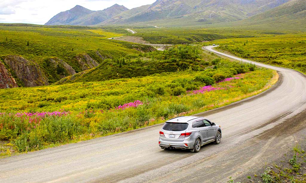
For our next scenic drive, we venture into Canada’s far north to explore the Dempster Highway. This rugged, 736-kilometer gravel road is Canada’s only all-season road to cross the Arctic Circle.
Key Features:
- Length: 736 kilometers (457 miles)
- Duration: 12-14 hours without stops, but 3-5 days is recommended for the full experience.
- Best Time to Visit: For the best road conditions and 24-hour daylight, visit June to September.
The Dempster Highway begins near Dawson City, Yukon, and ends in Inuvik, Northwest Territories. This remote wilderness road takes you through some of the most untouched landscapes in North America, crossing two mountain ranges and the Arctic Circle.
As you drive north, you’ll witness the transition from the boreal forest to the arctic tundra. The landscape becomes increasingly stark and beautiful, with endless vistas of mountains, rivers, and, in the fall, a tundra ablaze with autumn colors.
Key points of interest along the Delaware Highway include:
- Tombstone Territorial Park: Known for its rugged peaks and vibrant fall colors
- Arctic Circle Crossing: A sign indicates this is a popular location for photos.
- Eagle Plains: The only service stop along the highway, roughly halfway to Inuvik
The Dempster Highway poses a significant challenge. It’s a gravel road that can be challenging in poor weather conditions. Drivers should be prepared with spare tires, emergency supplies, and a full gas tank. However, for those willing to take on the challenge, it offers an unparalleled opportunity to experience the raw beauty of Canada’s North.
Wildlife sightings are common along the Dempster. Keep an eye out for caribou, grizzly bears, wolves, and a variety of bird species. In Inuvik, you can learn about the culture of the Gwich’in and Inuvialuit peoples, who have called this harsh but beautiful land home for thousands of years.
The Dempster Highway is more than just a road; it’s an adventure into one of the last outstanding wilderness areas in North America. It’s a journey that will leave you with a newfound appreciation for the vastness and beauty of Canada’s northern landscapes.
6. Fundy Coastal Drive, New Brunswick
Our journey now takes us back to Atlantic Canada to explore the Fundy Coastal Drive in New Brunswick. This scenic route follows the coast of the Bay of Fundy, which is home to the world’s highest tides.
Key Features:
- Length: Approximately 460 kilometers (286 miles)
- Duration: To fully experience the area, 5-7 days are recommended.
- Best Time to Visit: June to October for the best weather and whale watching opportunities.
The Fundy Coastal Drive runs from St. Stephen to Sackville, hugging the Bay of Fundy’s coastline. This drive offers a perfect blend of natural wonders, charming coastal towns, and rich maritime history.
The main attraction of this route is, of course, the Bay of Fundy itself. Twice daily, 160 billion tons of water flow in and out of the bay, creating tides that can reach up to 16 meters (52 feet) in height. This natural phenomenon shapes the landscape and creates unique opportunities for visitors.
Important locations along the Fundy Coastal Drive are as follows:
- Hopewell Rocks: Massive, flower-pot-shaped rocks that you can walk around at low tide and kayak between at high tide.
- Fundy National Park: Offering hiking trails, waterfalls, and a golf course with stunning coastal views
- St. Andrews by the Sea: A charming seaside resort town known for its beautifully preserved 18th and 19th-century buildings
The drive also takes you through Saint John, New Brunswick’s largest city, where you can witness the Reversing Falls. This unique phenomenon occurs when the rising tide pushes the St. John River backwards, creating rapids and whirlpools.
Wildlife enthusiasts will appreciate the opportunities for whale watching in the Bay of Fundy. The nutrient-rich waters attract several species of whales, including humpback, finback, and the rare North Atlantic right whale.
The Fundy Coastal Drive is not just about natural wonders. Each lighthouse along the route tells a unique story. You’ll also have the chance to explore quaint fishing villages and sample fresh seafood, including the region’s famous lobster.
This scenic drive provides a fascinating look at how the Bay of Fundy’s powerful tides have shaped both the landscape and the way of life in this part of Canada. It’s a journey that connects you with the rhythm of the tides and the rich maritime heritage of Atlantic Canada.
7. Yellowhead Highway, British Columbia to Manitoba
Our next scenic drive takes us on a cross-country journey along the Yellowhead Highway. This major route spans four provinces, offering a diverse cross-section of Canada’s landscapes and cultures.
Key Features:
- Length: Approximately 2,960 kilometers (1,840 miles) from Vancouver to Winnipeg
- Duration: 5-7 days for the full route, but many travelers choose to explore sections.
- Best Time to Visit: For the best weather conditions, visit May to September.
The Yellowhead Highway, also known as Highway 16, begins in Vancouver, British Columbia, and stretches east through Alberta, Saskatchewan, and into Manitoba, ending in Winnipeg. While the entire route offers captivating sights, we’ll focus on some of the most scenic portions.
In British Columbia, the highway winds through the Coast Mountains and into the interior, passing through diverse landscapes from rainforests to semi-arid valleys. This section’s key attractions include:
- Mount Robson Provincial Park: Home to the highest peak in the Canadian Rockies
- Jasper National Park: Offering stunning mountain scenery, wildlife viewing, and outdoor activities
As the highway enters Alberta, it passes through Edmonton, the province’s capital, before continuing east into the prairies. In Saskatchewan and Manitoba, the landscape transforms into vast expanses of farmland and rolling hills.
The following are some notable stops along the eastern portion of the route:
- Elk Island National Park, Alberta: A refuge for bison, elk, and over 250 bird species
- Riding Mountain National Park, Manitoba: An island of wilderness surrounded by farmland, known for its clear lakes and diverse wildlife
The Yellowhead Highway offers a unique opportunity to experience the gradual transition of landscapes from the Pacific coast to the Canadian prairies. Along the way, you’ll pass through numerous small towns, each with its own unique character and history.
This route also provides insight into Canada’s indigenous cultures. Many communities along the highway have significant First Nations populations, offering opportunities to learn about their traditions and contemporary lives.
The Yellowhead Highway is more than just a cross-country route; it’s a journey through the heart of Western Canada, showcasing the country’s geographic and cultural diversity. Whether you drive the entire distance or explore a section, this scenic route offers a comprehensive look at the Canadian landscape and way of life.
8. Georgian Bay Coastal Route, Ontario
Our journey now takes us to Ontario to explore the Georgian Bay Coastal Route. This circular drive around the shores of Georgian Bay, often called the “sixth Great Lake,” offers a perfect blend of natural beauty, outdoor adventure, and small-town charm.
Key Features:
- Length: Approximately 1,300 kilometers (808 miles)
- Duration: 3-5 days recommended
- Best Time to Visit: June to October for the best weather and fall colors
The Georgian Bay Coastal Route takes you through some of Ontario’s most picturesque landscapes, from the rugged shores of the Canadian Shield to sandy beaches and historic lighthouses. The route circles Georgian Bay, passing through charming coastal towns and offering stunning views of the bay’s crystal-clear blue waters.
Key attractions along the Georgian Bay Coastal Route include:
- Bruce Peninsula National Park: Known for its clear turquoise waters and unique limestone cliffs
- Fathom Five National Marine Park: Home to numerous shipwrecks and the famous Flowerpot Island.
- Killarney Provincial Park: Offering stunning landscapes that inspired the Group of Seven painters
- Manitoulin Island: The world’s largest freshwater island, rich in indigenous culture
The route also passes through several charming towns, each with its own unique character:
- Tobermory: A picturesque harbor town, known as the “freshwater SCUBA diving capital of the world.”
- Parry Sound: The birthplace of hockey legend Bobby Orr and home to the Bobby Orr Hall of Fame
- Midland: Features murals depicting the area’s history and the Sainte-Marie among the Hurons historic site.
Georgian Bay is known for its 30,000 islands, the world’s largest freshwater archipelago. These islands create a stunning backdrop for boating, kayaking, and canoeing. Many of these islands are part of provincial parks or conservation areas, offering opportunities for camping and wildlife viewing.
The Georgian Bay Coastal Route is not just about natural beauty. It’s also rich in cultural history. The area has been home to indigenous peoples for thousands of years, and you can learn about their history and culture at places like the Ojibwe Cultural Foundation on Manitoulin Island.
For those interested in maritime history, the route passes by numerous lighthouses, each with its own story to tell. The Imperial Tower lighthouse on Manitoulin Island and the Pointe au Baril lighthouse are particularly noteworthy.
The Georgian Bay Coastal Route offers a perfect mix of outdoor adventure, cultural experiences, and relaxation. Whether you’re hiking the rugged trails of the Bruce Peninsula, exploring the quaint shops in lakeside towns, or simply enjoying the stunning coastal views, this scenic drive showcases some of the best that Ontario has to offer.
9. Gaspé Peninsula Loop, Quebec
Our penultimate scenic drive takes us to Quebec’s Gaspé Peninsula, a region known for its rugged coastal scenery, charming seaside villages, and rich history.
Key Features:
- Length: Approximately 1,200 kilometers (745 miles)
- Duration: 4-7 days recommended
- Best Time to Visit: June to September for the best weather, whale watching, and bird viewing.
The Gaspé Peninsula Loop, also known as the Gaspésie Tour, circles the eastern tip of Quebec, offering stunning views of the Gulf of St. Lawrence and the Appalachian Mountains. This drive takes you through a landscape of dramatic cliffs, sandy beaches, and picturesque lighthouses, interspersed with quaint fishing villages and historic sites.
Key attractions along the Gaspé Peninsula Loop include:
- Percé Rock: A massive limestone stack with a natural arch, one of the most photographed natural sites in Quebec
- Bonaventure Island: Home to North America’s largest colony of northern gannets
- Forillon National Park: Offering hiking trails with stunning coastal views and opportunities for whale watching
- Gaspésie National Park: Known for its unique mix of coastal and mountain scenery, home to caribou and moose
The route passes through several charming towns, each with its own unique character:
- Gaspé: The birthplace of Canada, where Jacques Cartier first claimed the land for France in 1534.
- Matane: Known for its delicious Nordic shrimp and the gateway to the Chic-Choc Mountains
- Carleton-sur-Mer: A popular resort town with beautiful beaches and a vibrant cultural scene
The Gaspé Peninsula is also known for its culinary delights. Fresh seafood is a staple, with local specialties including lobster, crab, and, of course, Matane shrimp. The region is also famous for its maple syrup and artisanal cheeses.
For history buffs, the peninsula offers numerous sites of interest. The Birthplace of Canada site in Gaspé and the Site historique du Banc-de-Pêche-de-Paspébiac offer insights into the region’s rich history, from First Nations settlements to European colonization and the development of the fishing industry.
The Gaspé Peninsula Loop is more than just a scenic drive; it’s a journey through a unique corner of Quebec that blends natural beauty, rich history, and vibrant local culture. Whether you’re watching whales off the coast, hiking in the Chic-Choc Mountains, or enjoying fresh seafood in a quaint fishing village, the Gaspé Peninsula offers a diverse and unforgettable road trip experience.
10. Alaska Highway, British Columbia to Yukon
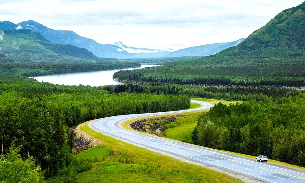
Our final scenic drive takes us back to Western Canada for an epic journey along the Alaska Highway. While this highway extends into Alaska, we’ll focus on the Canadian portion, which offers an incredible adventure through some of the country’s most remote and beautiful landscapes.
Key Features:
- Length: Approximately 2,232 kilometers (1,387 miles) from Dawson Creek, BC, to Delta Junction, Alaska (Canadian portion ends at the Yukon-Alaska border).
- Duration: 5-7 days are recommended for the Canadian portion.
- Best Time to Visit: June to September for the best weather and road conditions
During World War II, the military built the Alaska Highway, also known as the Alcan Highway, as a military supply route. Today, it’s a vital link to the north and a popular route for adventurous road trippers. The highway begins in Dawson Creek, British Columbia, and winds its way through northern BC and the Yukon before crossing into Alaska.
The following are key attractions along the Canadian portion of the Alaska Highway:
- Mile 0 Sign in Dawson Creek: The Alaska Highway’s official starting point
- Liard River Hot Springs Provincial Park: Natural hot springs in a beautiful boreal forest setting
- Muncho Lake Provincial Park: Known for its jade-colored lake and wildlife viewing opportunities
- Signpost Forest in Watson Lake: A unique collection of over 77,000 signposts from around the world
- Kluane National Park and Reserve: Home to Canada’s highest peak, Mount Logan, and vast ice fields
The Alaska Highway traverses some of the most pristine wilderness in North America. The landscape changes dramatically as you drive, from the rolling hills of the Peace River region to the rugged peaks of the Rocky Mountains and the vast boreal forests of the Yukon.
Wildlife viewing is one of the highlights of this drive. Keep an eye out for bison, moose, black bears, and mountain goats along the road. Bird watchers will also find plenty to see, with species ranging from trumpeter swans to golden eagles.
While the Alaska Highway is now a modern, well-maintained road, it still passes through some very remote areas. Carrying a full tank of gas, a spare tire, and emergency supplies is crucial for travelers. Although services may be scarce, this isolation contributes to the unique experience of the drive.
The Alaska Highway is not just a road; it’s a journey through history and untamed wilderness. It offers a unique opportunity to experience the vastness of northern Canada, from its dramatic landscapes to its resilient communities. Whether you’re soaking in the Liard Hot Springs, marveling at the wildlife, or simply enjoying the endless views, the Alaska Highway provides an unforgettable road trip adventure.
Conclusion
Canada’s vast and varied landscape offers some of the most spectacular scenic drives in the world. From the coastal beauty of the Cabot Trail to the mountain grandeur of the Icefields Parkway, from the historic charm of the Gaspé Peninsula to the rugged wilderness of the Alaska Highway, these ten scenic roads showcase the incredible diversity of Canada’s natural and cultural heritage.
Each of these routes offers more than just beautiful views. They provide opportunities to connect with nature, learn about Canada’s history and cultures, and create unforgettable memories. Whether you’re watching whales off the coast of Newfoundland, hiking in the Rocky Mountains, or exploring charming fishing villages in Quebec, these road trips offer experiences that will stay with you long after the journey is over.
As you plan your Canadian road trip adventure, remember to respect the environment, be prepared for changing weather conditions, and take the time to interact with local communities along the way. The journey and discoveries along Canada’s scenic roads are as important as the destinations.
So pack your bags, fill up the tank, and hit the road. Explore Canada’s incredible scenic drives, offering adventures through some of the most beautiful landscapes North America has to offer. Happy travels!

